
If you know anything about the Faroe Islands, you’ve probably seen photos of Lake Sørvágsvatn. This is the famous lake that appears to float high above the ocean along the edge of a rugged cliff.
What makes this place so special is the optical illusion. The lake is actually sitting only slightly above sea level, but because of the dramatic cliffs below it, it looks like the water is suspended hundreds of feet above the Atlantic Ocean.
It’s one of the most photographed places in the Faroe Islands — and once you see it in person, it’s easy to understand why.
The photos are breathtaking, but hiking out to the viewpoints and seeing it with your own eyes is even better. In my opinion, this is one of the best hikes in the Faroe Islands and easily one of the top things to do while visiting.

Lake Sørvágsvatn or Lake Leitisvatn? (Why the Names Are Confusing)
When researching this hike, you’ll probably notice several different names used for the same place.
Lake Sørvágsvatn and Lake Leitisvatn are the same lake, and the two names are often used interchangeably.
The cliffs where you see the famous “lake above the ocean” optical illusion are called Trælanípa, which translates to Slave Cliffs in English.
The hike itself is often referred to as the Trælanípa and Bøsdalafossur hike, although many travelers simply call it the Lake Sørvágsvatn hike.
When I first started researching this hike, I remember being pretty confused about what was what — especially since sites like AllTrails tend to mix several of the names together.
Hopefully this helps clear things up!
Trælanípa and Bøsdalafossur Hike Trailhead & Parking
The trail begins at a large parking lot near the village of Miðvágur on Vágar Island.
Parking here is free, and when I visited there were plenty of spaces available.
I highly recommend using the exact Google Maps coordinates for the trailhead when navigating. Google Maps can occasionally be inaccurate in the Faroe Islands, and the coordinates will take you directly to the correct parking area.
At the trailhead you’ll also find:
• Restrooms
• Picnic tables
• A small shop selling drinks and snacks


Cost of the Hike & Where to Pay
When I arrived, I initially wasn’t sure where to pay for the hike. Another couple nearby was equally confused.
We eventually figured it out together.
To access the trail, you’ll walk through the main gate and pay at the register inside the small shop located near the parking area.
The cost is 200 DKK per person (about $28 USD).
You can pay with cash or card, and the shop also sells drinks and snacks.
Yes — 200 DKK is a bit pricey for a hike. But in my opinion, the views are absolutely worth it.

Lake Sørvágsvatn Hike Details (Distance, Difficulty & Trail Info)
- Location: Vágar Island (15 minutes form the airport)
- Trailhead: Trælanípa/Bøsdalafossur car park, Miðvágur | Google Maps
- Cost: 200 DKK per person ($28 USD) (ages 16+)
- Length: 7.2 km (around 4.5 mile) out and back trail
- Route type: Out and back
- Duration: 1.5 to 2 hours
- Total elevation gain: 110 meters (360 ft)
- Difficulty: Easy (the very end of the hike to the viewpoints is quite steep though)
Best Time to Hike to Lake Sørvágsvatn
The most important factor when planning this hike is the weather.
The Faroe Islands are known for unpredictable conditions, and strong winds can make the exposed cliffs at Trælanípa feel uncomfortable — or even unsafe. If the weather is stormy or the winds are extremely strong, this probably isn’t the day to attempt the hike.
If possible, try to plan your visit for a day with lighter winds and calmer conditions.
Rain, on the other hand, usually isn’t a problem. The Faroe Islands get rain frequently, and the trail is still very doable in light rain — just expect some muddy sections along the path.
When I visited the Faroe Islands in October, the trail was actually very quiet. At times I had the viewpoints completely to myself.
Before heading out, it’s worth checking the forecast on Yr.no, which is one of the most reliable weather sources for the Faroe Islands. Because conditions can change quickly, it’s a good idea to stay flexible with your plans and hike on the day with the best weather.

I don’t know about you but I would not want to be standing on the edge of that cliff on a windy day.
Hike to Trælanípa and Bøsdalafoss Waterfall
Trælanípa translates to Slave Cliff and supposedly got its name from the Viking Age when they use to push disobedient slaves off the cliff. Yikes. Some things are better left untranslated.
The cliffs are a whopping 500 ft (about 152 meters) high! You can check out the video below to see just how high they actually are.
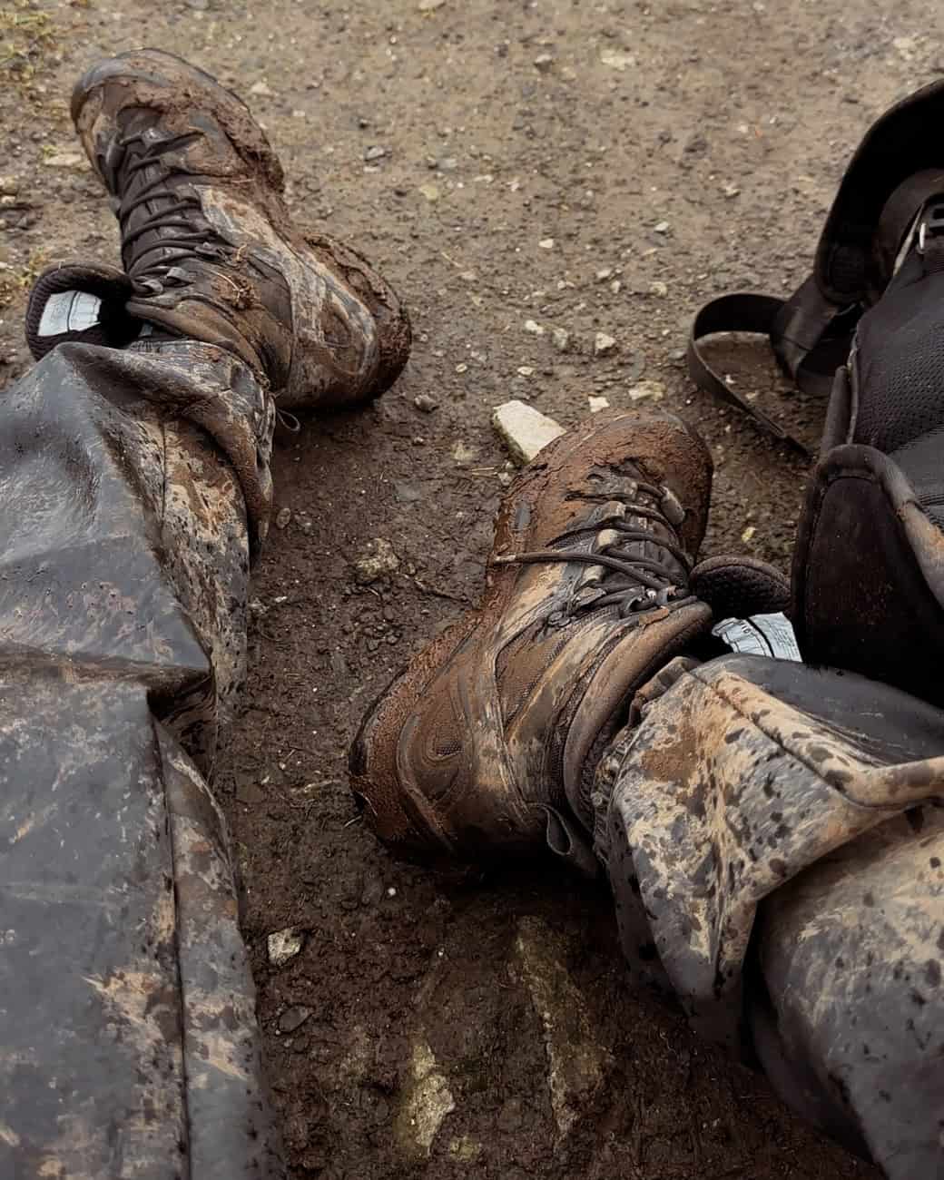
I highly recommend a good pair of waterproof shoes as the path can get muddy if it has rained recently. I wore my waterproof Saloman hiking boots; they’ve never let me down. Technically they are mens, but they also offer women’s sizing.
Beginning of the Lake Sørvágsvatn Hike
The hike itself is very easy and mostly flat.
The path is wide and well defined, so there’s never really a point where you’ll feel unsure about where you’re going.
You’ll walk alongside Lake Sørvágsvatn (Leitisvatn) for most of the hike as you head toward the Trælanípa cliffs.
I’ve heard some people say the walk out to the viewpoint is underwhelming, but I actually loved it. The scenery along the lake is beautiful and the views get better as you continue along the trail.
Along the way you’ll pass a few small streams running down the hillside. Most of the time they’re shallow enough that you can easily step across them without getting your feet wet.
If it has rained recently, the trail can get very muddy in places, so waterproof hiking boots are highly recommended.
I wore my waterproof Salomon hiking boots and they worked perfectly. Even in the muddiest sections my feet stayed completely dry. At the end of the day I just hose them off and they’re good as new.

The Trælanípa Viewpoint (Lake Above the Ocean)
The only challenging part of the hike comes right at the end.
To reach the main viewpoints you’ll climb a short but fairly steep section of stairs. I’ll admit I was a little winded by the time I reached the top.
But the moment you arrive at the viewpoint, the view completely makes up for it.
Seeing Lake Sørvágsvatn appear to hover above the ocean is truly incredible in person.

The Trail Splits at the Viewpoint
The only place where I felt slightly confused on the trail was once I reached the first viewpoint.
Here the path splits into several smaller trails leading in different directions.
Two of the paths lead to different cliff viewpoints overlooking the lake and ocean, while another path continues toward Bøsdalafossur waterfall.
The good news is that all of these paths are short, so even if you accidentally go the wrong direction it’s easy to backtrack.
I recommend taking the time to explore all of them, since each viewpoint offers a slightly different perspective of the lake.
Bøsdalafossur Waterfall (Don’t Skip This)
The Bøsdalafossur waterfall often gets overlooked because most people come here specifically for the Trælanípa viewpoint.
But honestly, I thought the waterfall was one of the coolest parts of the entire hike.
This is where Lake Sørvágsvatn flows directly into the Atlantic Ocean, cascading over the cliffs below.
The waterfall is about 38 meters (125 feet) tall, and standing near the edge watching the lake pour out into the ocean is an incredible sight.
One interesting fact about the lake is that it reaches a maximum depth of about 60 meters (200 feet), meaning much of the lake actually sits below sea level while the surrounding cliffs hold the freshwater in place.
Geituskorardrangur Sea Stack
Just beyond Bøsdalafossur you’ll also see Geituskorardrangur, a massive sea stack rising out of the ocean.
The rock formation stands about 116 meters (380 feet) tall, and the best views of it are from the cliffs near the waterfall.
If you’re already hiking to the waterfall, it only takes about 10 extra minutes to walk far enough to see this impressive sea stack.

How to Get to the Lake Sørvágsvatn Hike
The trailhead is located on Vágar Island.
From the capital city of Tórshavn, the drive takes about 45 minutes.
If you’re arriving by plane, the hike is extremely convenient — the trailhead is only about 15 minutes from Vágar Airport.
How Much Time Should You Plan for the Lake Sørvágsvatn Hike?
This really depends on your travel style.
If you’re like my husband, you might power through the hike in about 45 minutes to the viewpoint, spend a few minutes taking photos, and head right back to the car.
Total time: about 1.5–2 hours
If you’re more like me, you might end up spending the entire day here.
I arrived around 9:30 AM and didn’t leave until nearly 7 PM. I spent hours exploring different viewpoints, flying my drone, and walking out to Bøsdalafossur waterfall before staying for sunset.
By the time I returned to my car, it was almost dark.
And honestly, I loved every second of it.
For most travelers, I’d recommend planning 2–4 hours to fully enjoy the hike and viewpoints.
Is the Lake Sørvágsvatn Hike Worth It?
Absolutely.
The hike to Trælanípa and Bøsdalafossur waterfall ended up being my favorite hike in the Faroe Islands.
And if you do this hike, make sure you continue on to Bøsdalafossur waterfall. I almost skipped it because it wasn’t the “main attraction,” but it ended up being way cooler than I expected.
I’m so glad I took the extra time to see it.
Other Things to See Near Lake Sørvágsvatn
If you’re already on Vágar Island to hike to Lake Sørvágsvatn, there are several other incredible places nearby that are easy to add to your itinerary.
Múlafossur Waterfall (Gásadalur)
One of the most iconic views in the Faroe Islands, Múlafossur Waterfall dramatically spills over the cliffs into the Atlantic Ocean right beside the village of Gásadalur.
The waterfall is only about a 20 minute drive from the Lake Sørvágsvatn trailhead, making it a perfect stop before or after your hike. The viewpoint overlooking the waterfall and village is one of the most photographed spots in the Faroes.
Bøur Village
The tiny village of Bøur offers one of the most beautiful viewpoints in the Faroe Islands. From here you can see the dramatic sea stacks Drangarnir and Tindhólmur rising out of the ocean.
It’s an incredibly peaceful place and one of my favorite quick stops on Vágar Island.
Sørvágur Village
If you’re looking for a place to grab a coffee or a meal after the hike, the small village of Sørvágur is located just a few minutes away.
It’s also the starting point for boat tours to the famous Drangarnir sea stacks, one of the most unique landscapes in the Faroe Islands.
Vágar Airport
The hike to Lake Sørvágsvatn is incredibly convenient if you’re flying in or out of Vágar. The airport is only about 15 minutes from the trailhead.
On one of my visits, I actually planned the hike around dropping my husband off at the airport since the weather happened to be good that day. With the trailhead so close, it was an easy way to take advantage of the good weather and squeeze in one last adventure before heading back.
If you’re arriving early or have time before a flight, this hike is actually a great option for your arrival or departure day.


")
")
